Crew of Zoey's Adventure

Thursday, August 23, 2018

Orillia to Big Chute

Sunday - July 29, 2018   Orillia to Big Chute

It's been some time since I wrote a post to the blog. The reason being, we took a little trip home for an 80th Birthday. " Happy Birthday June" and to visit with Jered, Amanda and of course Wyatt! We left July 18th and returned to the boat on July 27th. A few days longer than planned because yours truly needed to go to the the doctors because of an issue with bursitis in the hip that actually started on the Sunday before we left for home. It's not better yet but hopefully time will heal. Not sure if I like this getting older thing?

On Sunday July 29th, we broke a Cardinal Looper Rule, "DO NOT TRAVEL ON A WEEKEND", but off we went and did we ever encounter heavy boat traffic along the way to the Big Chute. Lots of boats make for very busy locks and very slow going. 7 hours to go 28 miles with only 2 locks. In the past when we locked through on a weekday we were by ourselves in the lock or maybe one or two other boats. Today the lock master packed the lock with as many boats and jet-skis as possible. The plus side was it was a beautiful day and lots to look at. In fact is was nice to be back on the boat and moving again.

 There are 5 boats plus 3 jet skies in the lock.
 We were first in the next lock but you can see they fit in 3 boats behind us.


This is lock #43, Swift Rapids, the last lock before the Big Chute. We start at the top of the lock and descend 41.9 feet to the bottom.

In the bottom photo, you can see that it is just a big cement box.  This was one of the last locks to be built and Canada was running out of money because of the war.


Our destination is Big Chute Marina and after 7 hours it was nice to tie up and shut the boat down. This marina is the last marina before entering the Big Chute.  The evening and setting was beautiful as we dined on the aft-deck with yet another spectacular view! We are now almost to the end of the Trent-Severn Waterway. The Big Chute and one lock after that.


 This is the view from our aft deck.  The picture below is a preview of The Big Chute, which we watched from the marina we were docked at.


Trent Severn Waterway - Big Chute to Victoria Harbor

Monday - July 30, 2018

Well the big day is finally here on any Loopers cruise.... the BIG CHUTE!!!!

Good thing we took lots of pictures and a video, but the video does not work on this site, because this is difficult to explain in words. It seems that as they were building the TSW, at the closing of WWI, there was not enough money to build an actual lock so it was decided to build a temporary marine railway that would descend into the water thus allowing boats to float on to the carriage. Once on the carriage, each boat would be supported by two big straps that hold the boats in place as the carriage is now moved along a railroad track up out of the water, across the street (gates halt traffic) than down the hill to the next body of water where the carriage then descends into the water allowing the boats to re-float and drive off on their way. You got to see it to believe it!

This is our day for the Big Chute. As with all the locks they open at 9:00 am. Another Looper was on the Blue Line, this is where boaters wait until they are called into the chute. Being this was Monday there were no other boats waiting so we took our time getting to the Blue Line, in fact from where we were docked we could see the Big Chute so when it took the first boat up and over we then fired up the engines and made our way just across the channel to the Blue Line wall. Before we could tie to the wall the lock-master was calling us in to take our position in the carriage. I must say, I have been anticipating this day for 3 years and frankly was not at all nervous.  Now, I am not sure Lou Ann shared those same feelings.

 This is the Looper that was in front of us.  Since we could take pictures of Zoey's Adventure entering the Chute we have to use pictures of another boat.


As we slowly approach, the carriage staff takes great pride in taking great care of all the boats they transfer to the next body of water. Keep in mind we have a lot of running gear under the boat that could easily be damaged if not supported properly. We also weigh more than 35,000 pounds with fuel, water and ALL the gear on board. Once we are in/on top of the carriage the staff starts to adjust the holding straps, engines still running they ask me to just nudge the boat a few inches forward. Then the straps are made tight and the staff asked to shut the engines down (can't run the engines when the boat is out of the water).  Next thing we know we are on our way up the hill, across the street and down to the other side as the carriage begins its slow and steady journey.  In all we traveled about 1/8 of a mile out of the water and dropped 60 feet to the lower level. What a ride and it all took less than 5 minutes!

 This is what the Chute carriage looks like, similar to a marina travel lift.  If you look carefully, there is a smaller boat in the Chute.
The Chute is in the water and we are entering. 
Keep in mind that this Chute can hold 2 larger boats or 4 small boats


This is the Chute operator in charge of lifting the boats out of the water in 2 slings.


 The Chute has started its journey up out of the water
This is our view as we are up out of the water

 The Chute is traveling across the street.  This view is looking back from where we came out of the water.
We have now crossed the street and are heading down the hill to the next body of water.  It is a little daunting standing on the boat looking down hill.  It's almost like the first drop on a roller coaster only this car goes nice and slow and stays level, which is a feat in its self.
Almost to the water

Looking back at the rail that we just came down.


Now there is only one lock left on the TSW at Port Severn. This lock is the smallest of all the locks. Again the government was running out of money at the end of the WWI so this lock was downsized.
Once through this very crowed lock, even on a Monday, we are the facing our final obstacle... Potato Passage.

This is a very narrow channel leading to the open waters of Severn Sound. At one point we stopped the boat to be 100% sure we were in the correct channel. Not only is it narrow but it makes not one, but two, 90 degree turns within only a few hundred feet. With this behind us we are able to get Zoey's Adventure up to cruising speed heading to Queen's Cove Marina in Victoria Harbor, ON.

 Views between the Big Chute and Port Severn.  These are not of Potato Passage.  We had to concentrate to hard to be able to take pictures.


Quick call on the VHF radio for a slip assignment and soon we are secure to the dock. Here we plan to spend three nights. We chose this marina because the owner was at the Loopers meeting in Trenton, the beginning of the TSW, and offered to meet with any Loopers interested in reviewing the charts of Georgian Bay and the 30,000 Islands. It's always a good thing to have some local knowledge when cruising in new territory and that's what we got. Robin, at the marina dropped off a complete set of paper charts with preferred routings highlighted as well as many recommended anchorages and a few places to avoid ROCKS. We then joined two other Looper couples and went over, in detail, the charts that we would be using for the next week as we head north up into Georgian Bay.

Not sure if I mentioned what we are using for navigation. In addition to paper charts (mandated by Canadian Coast Guard) we also have two different GPS chart-plotting systems. One is on the boats Garmin system and the other is on our IPad. Each day before heading out we both sit down and review, very closely, the paper charts and the area we plan to cover. Lou Ann follows along on the paper charts and I mostly use the IPad and we cross check often. Of coarse, it's easy on the TSW, because basically you can't make a wrong turn. On both paper and GPS there is a red line to follow, like the old AAA Triptik. By the way, Georgian Bay is about 3 or 4 times larger than Long Island Sound. It's not a body of water to take lightly.

One other thing, for the past few weeks there have been several forest fires burning, mostly out of control, in an area above Parry Sound resulting in the closing of some of the areas we had planned to cruise through including Collins Inlet. Not sure if this is any relation to the Collins' of South Windsor, CT?

To recap our journey on the TSW. We left Trenton, ON, on July 3rd and ended in Victoria Harbor, ON, on July 30th. We went home for 10 days so that leaves 18 day to travel 240 miles. During that time we locked through 41 locks, 2 lift locks and 1 rail carriage. From the time we left Lake Ontario, we went up 596 feet and by the time we exited the last lock at Port Severn we dropped 262 feet. Most of the 240 miles was at almost idle speed. The TSW is a series of interconnected Lakes, Rivers, Canals and cuts it way better than I had ever could have imagined. It was beautiful scenery, cute towns and villages and very friendly and gracious people.


Last thing. Should you like to be notified via email of our next posting on the blog...at the bottom of this page, "follow Zoey's Adventure" is a place to add your email address. When you submit your email address you will receive an email from blogger, asking for you to confirm you want to be notified each time we post a new message. It's that simple.

Monday, August 13, 2018

Trent-Severn Waterway - Lovesick to Orillia

Wednesday - July 11, 2018   Lovesick to Bobcaygeon - 1 Lock

These are the type of markers we run across while in the Trent-Severn.  You can see that the channel, the area between the red triangle and the green square, is not very wide and on either side is nothing but shallow rocks.

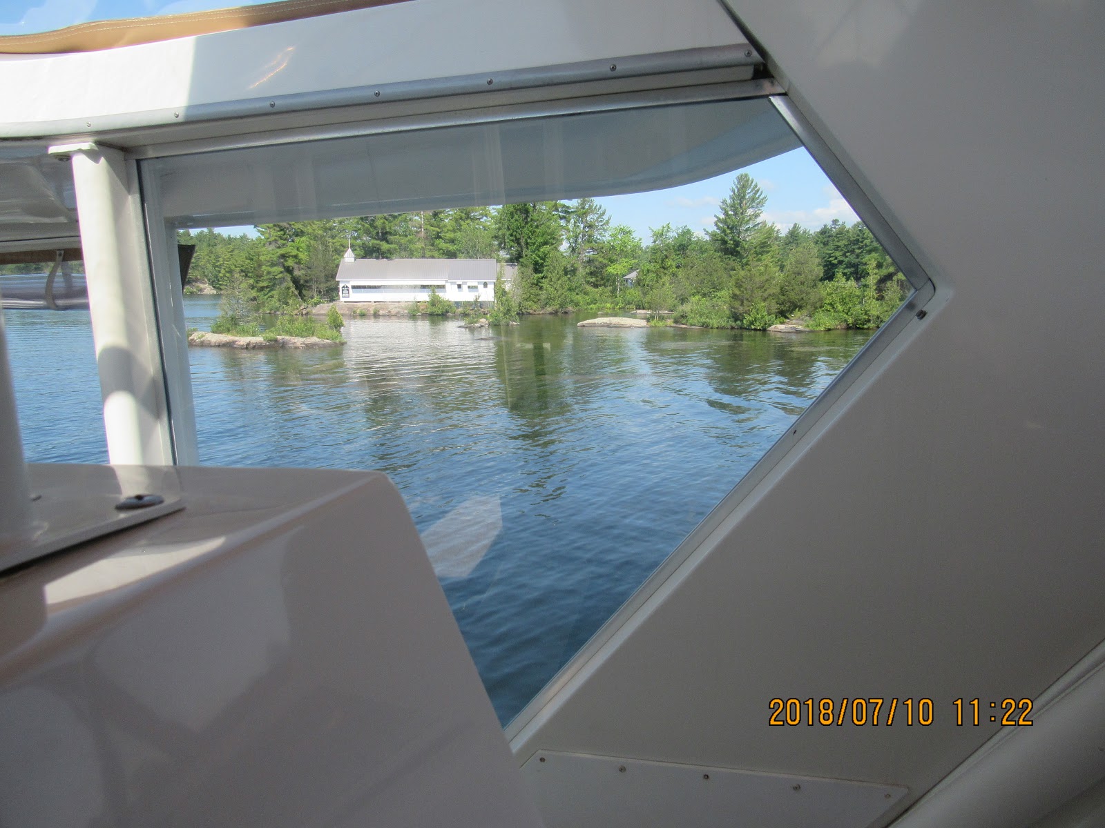
Again, the scenery is beautiful, but there are hundreds of narrow passages to navigate through.


This is the view from the little marina we were tied up to in Bobcaygeon.  To the left of the red marker is the entrance to Lock #31.


This is still the entrance to Lock #31 looking from the lock back to the marina we were staying at way in the back.  As with all locks, boaters can tie up before going through the lock or after, for up to 2 nights. There is a small fee of 90 cents per foot.


This is the Main Street of Bobcaygeon.  A lot of little shops and restaurants but the biggest attraction is Bigley Shoe Store.  If the captain gives the 1st mate a hard time going through the lock, the lock master will give the captain a coupon for 20% off at the shoe store.  Shoes, as with anything in Canada, are very expensive.


Thursday - July 12, 2018  Bobcaygeon to Fenelon Falls -  2 Locks

 Here we decided to take a bit of the one day trips so we spent 2 nights here on the lock wall.

 Views from Bobcaygeon to Fenelon Falls


 Kawartha Voyager - Cruise ship that travels the Trent-Severn from the Kawartha Lakes to Peterborough.  The blue bow folds up so that the ship can fit in the locks.


This ship went by us when we were tied to the wall at Fenelon Falls Lock. We were sure glad it went by us while we were there because it meant that we would not meet it along the canal up ahead and try and pass side by each.


 Fenelon Falls Dam.  The lock is to the right with the calm water

Mayboro Lodge - The Fenelon Museum


Saturday - July 14, 2018    Fenelon Falls to Kirkfield - 2 locks


The run to Kirkfield was fine until the last few miles on the very narrow canal. The locals call it "The Ditch". As we entered the canal we broadcast on the VHF radio a warning to any approaching boats we have entered the canal northbound. This canal is so narrow that two boats could not pass each other. At one point we exit the narrow canal into an well marked channel, now the depth-sounder is reading numbers you don't even what to look at - from 1 1/2 to 3 feet. We need 4 1/2 feet to keep Zoey's Adventure floating. On 3 occasions we did touch bottom but at idle speed.  Was there any damage to our two props... we were hoping not.

A sampling of what the "cottages" are like along
the narrows

These 2 pictures are of The Narrows or The Ditch.  It is very narrow and if 2 boats need to pass, you literally walk them by each other.  Not only is the canal narrow but it is very shallow.


It's been years since I hit bottom with a boat with inboard motors, and frankly can't remember what it sounds like. Because it is still very shallow we will not be able to determine if anything is bent or damaged until we can get Zoey's Adventure into the open water of Lake Simcoe.  Stay tuned, we are a day away from the big lake and open water.

Today we call it quits after the Kirkfield Lift Lock and spend a very quite night on the lock wall with just one other small boat. We got to see the lift lock operate many times and it truly is an engineering marvel! Oh by the way, we are now descending. In the lift lock we just secure the boat to the side of the chamber, it's so easy just ask LouAnn .


This is the Kirkfield Lift.  You drive the boat into a big tub of water that is 41 feet in the air.  Lou Ann argued with the lock attendant as to how far we were going forward in the lock. Very daunting, to say the least.  This is the highest section of the Trent-Severn at 840.5 feet.  We are now descending with each lock.

Kirkfield Lift Lock #36.  We were in the tub on the left, up in the air.


Sunday - July 15,2018   Kirkfield to Orillia  - 5 Locks

The lockmaster forgot to collect our dockage yesterday so we settled up this morning. Only about 11 miles to Lake Simcoe, but again slow going with narrow canals, channels and 5 locks.

At one lock when we exited there where seven boats coming up the canal so we decided to tie up on the the lock wall to wait for this flotilla to pass and enter the lock. No need to try to pass seven boats in such a narrow canal; one boat OK, but not seven in single file.


Seven boats in a row, all fitting into the same lock.  The lock staff told us there was plenty of room to pass but we didn't believe her.  The water is 6' - 8' in the middle but then the sides slope up to very shallow water.

All 7 boats fitting into the lock. The last boat entering the lock will squeeze between the last 2 boats.


Must say that we often look at the scenery as we are cruising and try to compare it to other places we have been. Today, we both felt that in the canal we were cruising through, reminded us of Europe with the farmland and farmhouses on both sides of the canal.

 Views along the waterway

This view is at one of the last locks on the Trent-Severn.  Acres and acres of farm land.

This is a flooded marsh.  There is a small channel and lots of grass and weeds on either side.


We are going through the swing bridge at the end of the Trent-Severn and the entrance to Lake Simcoe.


Then the moment of truth as we enter into Lake Simcoe and are able to get Zoey's Adventure up to cruising speed to see if any damage had been done to our underwater running gear. Good news, no damage and we can tell because the are no vibrations at any speed. When a prop is damaged, even the in the least little bit, it will cause a vibration. The propellers are perfectly balanced and even the slightest nick will throw them off balance. Had we done some damage we would have had to find a marina that could haul the boat, remove the damaged prop and send it/them out to be repaired. This process could take up to a week. We can not run the boat with damaged propellers as the vibrations would cause other issues.


Wednesday, August 8, 2018

Trent-Severn Waterway - Lakefield to Lovesick - 3 locks


Tuesday - July 10, 2018 - Lakefield to Lovesick


 Views on waterway from Lakefield to Lovesick.
Church on an island
Views on waterway


More views on the waterway.  The cottages and boats houses are amazing.  Mind you these are only summer cottages.


 After coming through the Lovesick lock we tie up to the upper wall. Lovesick lock is actually an island and the lock attendants have to come to work and leave by boat everyday.

When we arrived the lock master told us about "The Spa" and how to get to it.  We had to walk across the "new dam", built in 1954, pictures to far left.  As you can see there is construction going on with large chunks of cement missing and the wooden board walks have hugh holes and no hand railings.  This would never fly in the US.
 So after walking across the new dam and the old dam, we came to this pool, "The Spa".  A stone wall was built in the river to create a pool.
Rene entering the spa.  Water is about 74 degrees


 The water is about 3 feet deep and there are nice flat rocks to sit on
Views from the pool taken under the old dam 


This view is on the back side of the island.  The main waterway is in the back ground.


On our way back to the boat we noticed this sign and the rail.
This was so the canoes did not have or were not able to go through the lock.


Oh oh Lucy.... we got company.  We thought we were going to have the wall all to ourselves for a nice quite night.  At 5:30 pm, right when the locks were getting ready to close, these two house boats showed up.  There was no room fof them to tie up on the lower wall so they had to stay with us.  Between the 2 boats there were 2 families, 14 people.  I don't know how they all fit.  They were quite and respectful of us being there and we did the same for them.